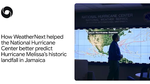
WeatherNext forecasted that Hurricane Melissa would rapidly intensify and make Category 5 landfall in Jamaica days before the storm struck in October 2025, a prediction that helped give forecasters and emergency teams additional lead time to warn communities and arrange evacuations. Melissa became the strongest storm on record to hit Jamaica and was tied for the strongest in the Atlantic, prompting heightened alerts and response across the island.
The model issued its Jamaica landfall forecast five days before impact, assigning roughly 80% confidence that rose to nearly 100% three days before landfall. Forecasters described the run as the first successful prediction of a storm reaching Category 5 strength after starting from Category 1 wind speeds, a notable achievement for intensity forecasting. WeatherNext was developed by Google DeepMind and Google Research as part of Google's Earth AI work and was trained on decades of global weather patterns alongside specialized datasets of extreme tropical cyclones. It is designed to produce track and intensity forecasts within a single system, rather than relying on separate models for each task.
That single‑system approach targets a longstanding tradeoff in forecasting: large global models typically capture storm track but lack the fine‑scale resolution to resolve small thunderstorms that drive intensity changes, while high‑resolution local models capture intensity drivers but can miss broader atmospheric context. According to developers and forecasters, WeatherNext narrows that gap by improving skill on both track and intensity and reducing the historical split in model capabilities.
Rapid intensification remains a particularly difficult phenomenon to predict; it is defined as a 35 mph or greater increase in wind speed within 24 hours. National Hurricane Center Director Michael Brennan has emphasized that the evolving structure and strength of tropical systems make such events hard to foresee, and NHC forecasters spent months validating WeatherNext in operational settings before Melissa's landfall.
Operationally, WeatherNext generates ensembles — typically about 50 'what‑if' scenarios — rather than a single best estimate, and its outputs were made available experimentally through Weather Lab. That ensemble approach, paired with prior validation, allowed emergency teams to mobilize and coordinate evacuations with more lead time; for planners and builders, the episode demonstrates the practical value of ensemble AI models trained on both global context and specialized cyclone records.
Sources
Replies (0)
No replies in this topic yet.